Strengthening Senegal's Future
Moving from Disaster Response to Risk-Informed Resilience
- The World Bank Group (WBG) and the Global Facility for Disaster Reduction and Recovery (GFDRR) have been steadfast partners of Senegal in its drive to move from reacting to disasters to proactively building resilient cities, coasts, and systems.
- Urban flood management offers one of the clearest examples of this shift. In Greater Dakar alone, WBG-financed investments, informed by GFDRR-supported analytics, have reduced flood risk for approximately 420,000 residents.
- The WBG and GFDRR partnership with Senegal has paid dividends for jobs and livelihoods. For example, WBG-financed investments in coastal protection infrastructure, informed by GFDRR-supported analytics, have been key to restoring beaches in Saly, Senegal’s main tourism hub.
Overview
In its Vision 2050 development plan, Senegal has set out its ambition to reach upper-middle-income status by 2050. Achieving that goal will require sustained growth, better jobs, and more resilient cities and coasts.
The resilience challenge is becoming more urgent. Threats like floods and sea-level rise are concentrated in coastal areas, such as metropolitan Dakar, where much of the country’s population and economic activity are located. Rapid urbanization and poorly planned urban growth have made these risks more complex. Informal settlements can obstruct drainage systems, while stormwater flooding has long affected hundreds of thousands of people each year.
The scale of this exposure has been building for decades. Explore the chart above to see how Senegal's settled area has grown since 1985 — and how the share of settlements in serious flood risk zones has expanded in lockstep with those on safe ground.
As underscored in the World Bank Group’s Country Climate and Development Report (CCDR) for Senegal, without action, annual economic losses could reach up to 4 percent of gross domestic product (GDP) by 2030. According to the same report, in intense climate scenarios, this could result pushing an additional 2 million people into poverty by 2050.
Responding to the urgency of these challenges, the government of Senegal is stepping up its efforts to build a more resilient future, moving from reacting to disasters to proactively building resilient cities, coasts, and systems. With support from the World Bank Group and the Global Facility for Disaster Reduction and Recovery (GFDRR), the country is using risk information, planning tools, drainage investments, coastal protection, and community engagement to better manage risks before they become disasters.
The results can be seen in Saint-Louis, where families are being supported to move out of high-risk coastal areas; in Greater Dakar, where drainage investments have reduced risk for approximately 420,000 residents; and in Saly, where beach restoration has helped protect Senegal’s main tourism hub.
Ahead of the GFDRR Partnership Dialogue, this immersive story takes a closer look at the results and lessons learned from these efforts to usher in a more resilient Senegal.

Photo: Lom Doudou via Pexels
Photo: Lom Doudou via Pexels

Photo: MartinezCodina via Flickr
Photo: MartinezCodina via Flickr

Photo: Patrick Schumacher via Flickr
Photo: Patrick Schumacher via Flickr

Photo: Imani Bahati via Unsplash
Photo: Imani Bahati via Unsplash
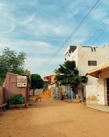
Saint-Louis
From Risk to Resilience: A Coastal Community Journey
In 2017 and 2018, severe storm surges in northwest Senegal, including the UNESCO World Heritage Site of Saint-Louis, exposed the risk faced by the thousands of people living in high-risk coastal areas.
Following these events, the Saint-Louis Emergency Recovery and Resilience Project (SERRP) (2018- present) has helped families to relocate out of high-risk zones, thus reducing their exposure to coastal flooding.
The project has supported the emergency relocation of 2,331 people into temporary housing, as well as the planning and construction of long-term housing, community infrastructure, and livelihood restoration programs. Both the short-term and long-term infrastructure are located away from high-risk zones.
As of May 2026, long-term relocation has already been completed for approximately 7,000 people, with a target of reaching 15,000 people by the end of 2026.
"Recovery means first taking care of those affected. They lost everything... So rehouse them, first temporarily, then rebuild to restore the lives and economic activities that they had before."
A defining feature of this project was its participatory approach, supported by a GFDRR grant. Communities were consulted on the design of the areas where people would resettle, including their preferences for housing, selection and layout of community facilities, the design of a livelihood's restoration plan, and other aspects.
The participatory approach also supported gender and inclusion, by engaging elderly, women, neighborhood leaders, young people, and civic associations, and by incorporating their feedback.
Photo: Mactar Seck via World Bank
Photo: Mactar Seck via World Bank
A further emphasis on the project was to build skills among local community members to enable them to take ownership of the new dwellings while making these new homes sustainable and improving their long-term income prospects. For example, a training program covering various building trades, such as bricklaying, electricity, and carpentry, will enable more than 200 young people to contribute to the upkeep and maintenance of the dwellings.
Beyond SERRP, GFDRR’s support in this part of Senegal has also funded studies that identified risk reduction options for Saint-Louis over the long-term. For instance, a GFDRR grant funded analyses identified coastal flood risk reduction options, including tree planting, beach nourishment, and a coastal protection infrastructure.
Photo: Image courtesy of CNES / Photothèque (Copernicus Sentinel Data, 2021)
Photo: Image courtesy of CNES / Photothèque (Copernicus Sentinel Data, 2021)
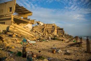
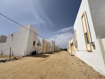
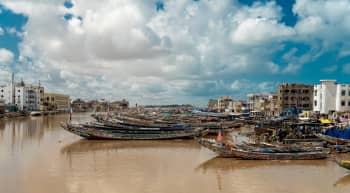
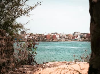
Photo: Ji-Elle via Wikimedia Commons
Photo: Ji-Elle via Wikimedia Commons
Photo: Thomas de Luze via Unsplash
Photo: Thomas de Luze via Unsplash
Photo: Patrick Schumacher via Flickr
Photo: Patrick Schumacher via Flickr
Photo by youssoupha kante via Unsplash
Photo by youssoupha kante via Unsplash
Greater Dakar
Transforming Urban Flood Management
Dakar, Senegal's capital and largest city, serves as the primary economic engine of the West African country.
Today, Greater Dakar contributes nearly half of the country's GDP.
Yet, Dakar's ability to drive growth and create jobs is stymied by recurrent flooding.
A GFDRR-supported flood risk analysis showed that 20 percent of critical infrastructure in four peri-urban areas of greater Dakar are exposed to flooding.
Photo: MartinezCodina via Flickr
Photo: MartinezCodina via Flickr
The Stormwater Management and Climate Change Adaptation Project 2 (PROGEP 2) (2021-present) and its predecessor have addressed urban flood risks through investments in drainage infrastructure and neighborhood upgrading in periphery areas of Dakar.
To date, PROGEP 2 has protected over 1,500 hectares of Greater Dakar from flooding, reducing risk for approximately 250,000 residents. Previously, the predecessor project (PROGEP) (2012-20) protected 900 hectares and nearly 170,000 residents through similar investments.
Photo: World Bank Group/GFDRR
Photo: World Bank Group/GFDRR
GFDRR funded flood risk analysis that informed the design of the drainage investments in Dakar under both PROGEP and PROGEP 2, including with respect to nature-based solutions.
By providing a sophisticated analysis of flood exposure and vulnerability, these studies helped identify the locations where investments should be targeted and led to recommendations for specific flood risk management investments, including traditional drainage investments and nature-based solutions.
"The flood risk study is a game-changer for our territorial planning in the Greater Dakar region, which is key to preventing and managing floods. By clearly identifying high-risk areas, we can steer development away from danger zones and better protect people and their property."
GFDRR assistance also helped uncover opportunities to incorporate nature-based solutions into drainage plans, including for some of the water retention basins constructed under PROGEP.
In addition, results of a nature-based solutions opportunity scan for Dakar and Thies in 2023 are being integrated into newly produced drainage master plans. Elements of the plans are being incorporated in PROGEP2 investments, for example, using wetlands and lakes as water retention basins.
Photo: World Bank Group
Photo: World Bank Group
The PROGEP model of drainage investments combined with incorporating flood hazard assessments and drainage plans into urban planning is now offering lessons elsewhere in the region.
Several countries are seeking to replicate elements of the model, including Ghana, Benin, Niger, the Republic of Congo, and the Democratic Republic of Congo.
Photo: GFDRR
Photo: GFDRR
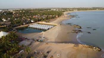
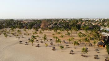
Saly
Protecting Coasts, Tourism, and Livelihoods
Located south of Dakar, Saly is Senegal’s main tourism hub and a substantial source of jobs and local livelihoods.
In Saly, coastal resilience is also economic resilience. The erosion of beaches in Saly by up to 6 meters a year had increasingly threatened the prospects for the tourism sector in Saly, with some hotels closing due to either damage from erosion or declining visitor numbers.
In response, the Senegal Tourism and Enterprise Development Project (2017-22) implemented critical measures which restored and protected beaches in Saly. These include the design and implementation of beach restoration measures using dredged sand, the expansion of beaches by 375,000 square meters, and the construction of 19 groins and breakwaters to mitigate erosion.
“It is such a relief for Saly’s entire population. When we talk about seaside tourism, it is largely thanks to the beach. We welcome the restoration of our beach.”
The project also developed institutional measures to facilitate the maintenance of the structures, which were established after the project closed.
GFDRR-funded analytics were instrumental in identifying several of the coastal protection design interventions implemented under the project.
Specifically, GFDRR funded studies that assessed and quantified the threats from sea level rise and coastal erosion and flooding, providing a cost benefit analysis of and recommendations for climate adaptation options for tourism areas.
Photo: Davric via Wikimedia Commons
Photo: Davric via Wikimedia Commons
These helped to persuade government to modify their investment plans to reduce the scale of investment in high-risk zones, to modify the design of investments they were undertaking to incorporate stormwater management, and to undertake beach replenishment and protection measures.
They also articulated the need for integrated coastal zone management and proposed models for operations and maintenance of coastal protection assets to be funded by tourism operators.
Planning for Risk
Changing How Cities Grow
Across all these investments, particularly in Dakar and Saint-Louis, support has also been provided toward capacity-building and the development of disaster-resilient urban plans.
A major driver behind this support has been to ensure that Senegal can sustain the progress it has achieved, in part by strengthening the country’s ownership of its resilience agenda.
More specifically, GFDRR and the World Bank have supported a new approach to urban planning which incorporates disaster resilience, incorporating drainage plans and flood risk mapping as part of urban master plans.
Bank-financed projects such as PROGEP, PROGEP2, and SERRP have enabled the development of tools to identify and enable urban planning policy priorities, a training program on urban planning, in addition to detailed urban plans for municipalities in Dakar and Saint-Louis which are now being implemented.
An image from the land deformation assessment of Saint-Louis, Senegal, based on data from Sentinel-1 satellite. Credit: CityCORE Africa
An image from the land deformation assessment of Saint-Louis, Senegal, based on data from Sentinel-1 satellite. Credit: CityCORE Africa
As a result, the government of Senegal has substantially improved its capacity to develop urban master plans that include and incorporate risk information and resilience requirements, drawing on hydraulic studies and flood maps.
Drawing on this improved capacity, the government is providing technical support to municipalities who are now responsible for developing these plans. Multiple GFDRR grants contributed to Senegal’s development of its urban planning agenda, funding analytics that assessed urban spatial development and resilience challenges as well as technical assistance for both the detailed design of detailed urban plans and for developing key urban planning policy reforms.
This included technical reviews and inputs into urban master plans developed under PROGEP, PROGEP2 and SERRP for municipalities in the Dakar and Saint-Louis metropolitan areas, policy dialogue and advice on a new urban code, and CityScans to assess urban growth patterns and resilience opportunities.
Supported by GFDRR’s City Resilience Program, CityScans provide a data-driven snapshot of a city’s demographic, economic, climate, and risk landscape.

Photo: Norbs Abadie
Photo: Norbs Abadie

Photo: Amaury Michaux via Pexels
Photo: Amaury Michaux via Pexels

Photo: Ada via Adobe Stock
Photo: Ada via Adobe Stock

Photo: Eyelit Studio via Unsplash
Photo: Eyelit Studio via Unsplash
Taking Stock and Looking Ahead:
GFDRR Partnership Dialogue
Looking ahead, the World Bank and GFDRR remain as committed as ever to sustaining and strengthening their partnership with Senegal, drawing on lessons learned from over a decade of collaboration.
In that spirit, the upcoming GFDRR Partnership Dialogue will provide an invaluable opportunity for government officials, GFDRR members, observers, and World Bank staff to take stock of what’s been achieved, with an eye toward gleaning lessons that can inform the next chapter of Senegal’s journey to resilience.
Additional Senegal References
Immersive Story Series Lead: Erika Vargas
Designed and Developed by: Yann Kerblat and Erika Vargas
Contributors: Yoko Kobayachi, Lorenzo Carrera, Stephen Hutton, Ana Campos, Cecile Lorillou, Isabelle Celine Kane, Jonas Ingemann Parby, Mamani Massiri Coulibaly, Sokhna Ba, Bianca Adam, Farah Dib, Mazen Bouri, Ndeye Ami Drame, Thomas Flochel, Ozgul Calicioglu, Ibrahima Samba, and Hatem Chahbani.
Video and Photo credits: World Bank Group unless otherwise noted.