Rising from the Depths
Water Security and Fragility in South Sudan
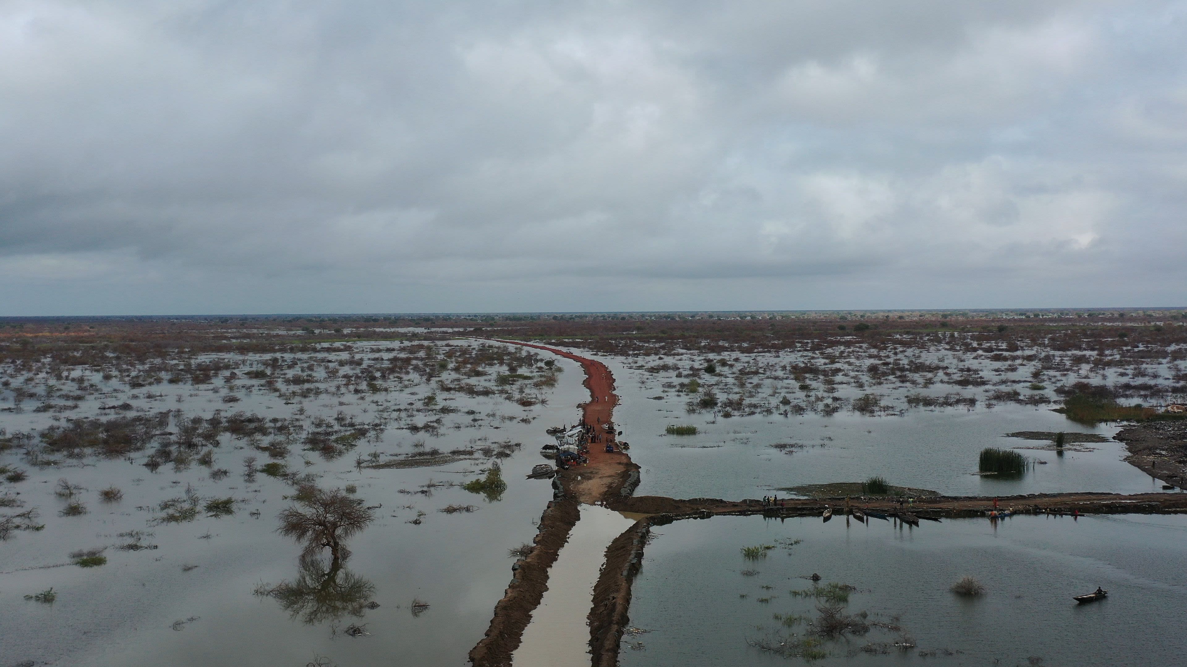
In 2022, South Sudan was ranked as the world’s most vulnerable country to climate change and has the lowest level of coping capacity. South Sudan is also one of the world’s most politically fragile countries, and faces as a result, a vicious cycle of water insecurity and fragility. Recently, extreme floods in 2020, 2021, and 2022 were a stark reminder of South Sudan's extremely high exposure to flood hazards, aggravated by the growing impact of climate change.
In 2021, floods in South Sudan affected about 1.2 million people, displaced more than 300,000 people and caused economic damages of $671 million.
At a global level, South Sudan ranks 7th out of 165 countries in terms of proportion of country population exposed to river floods in an average year.
While the South Sudanese have long dealt with such water-related risks, today’s situation is different for two reasons. First, decades of conflict and insecurity have undermined communities’ ability to cope with water-related risks. Second, climate change is tremendously increasing the destructive potential of floods.
As populations grow and climatic conditions rapidly change, the country’s vast and unique natural assets are, once again, coming under increasing scrutiny. What is water’s role in these dynamics? How can investments in the water sector support South Sudan’s efforts to recover from decades of conflict and strengthen the resilience of its communities?
South Sudan’s water endowment is profoundly intertwined with the Nile river basin, one of most complex riverine systems in the world. The majority of the country’s surface and groundwater resources are in this basin, whose variable flows therefore influence the country’s water availability and the occurrence of droughts and floods.

Water transport on the White Nile, in Upper Nile state, in the Greater Upper Nile region of northeastern South Sudan. Photo: Atamari
Water transport on the White Nile, in Upper Nile state, in the Greater Upper Nile region of northeastern South Sudan. Photo: Atamari
South Sudan can be divided into 3 main hydrological units (surface water systems).
The Bahr el Ghazal is 716 km (445 mi) long and is the main western tributary of the Nile. It flows through the Sudd wetlands to Lake No, where it joins the White Nile.


Jur River, the upper course of the river Bahr al-Ghazal in South Sudan. Photo: Michael Walsh
Jur River, the upper course of the river Bahr al-Ghazal in South Sudan. Photo: Michael Walsh
The Bahr el Jebel is 956 km (594 mi) long and receives the outflow from the East African lakes. As the river passes through the Sudd swamps it loses much of its volume through evaporation and dispersal. The river is also navigable all the way to Juba.

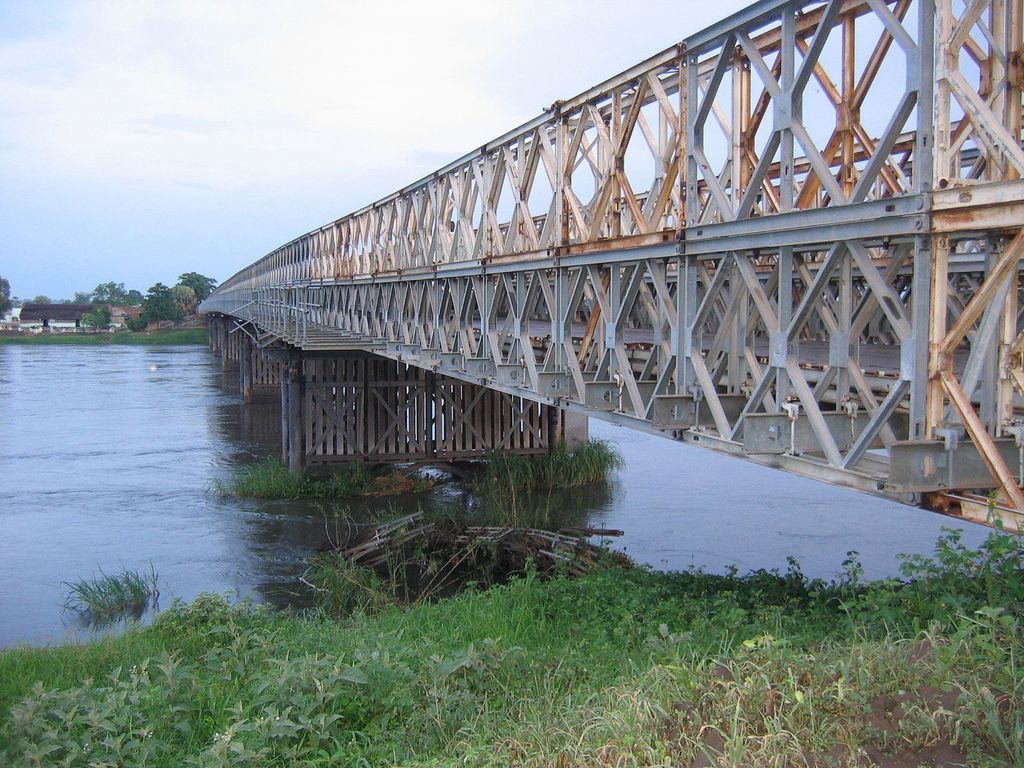
A steel bridge that passes over the River Nile situated in Juba, South Sudan. Photo: Demosh
A steel bridge that passes over the River Nile situated in Juba, South Sudan. Photo: Demosh
The Baro-Akobo-Sobat contributes 48% of the flow of the White Nile where these river systems join downstream of Malakal. Most of the runoff develops in the mountains and foothills of Ethiopia

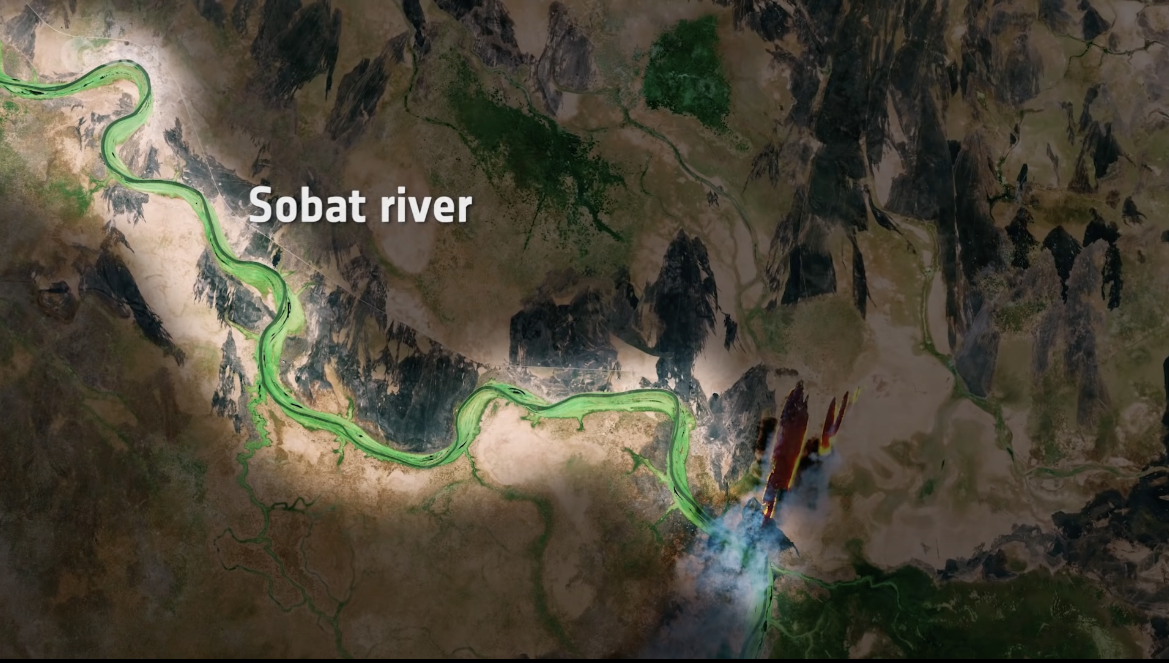
The Sobat river is traced in a vibrant green colour along the left part of the image. This is the most southerly of the great eastern tributaries of the White Nile, the section of the Nile between Malakal, South Sudan and Khartoum, Sudan. Photo: European Space Agency (ESA)
The Sobat river is traced in a vibrant green colour along the left part of the image. This is the most southerly of the great eastern tributaries of the White Nile, the section of the Nile between Malakal, South Sudan and Khartoum, Sudan. Photo: European Space Agency (ESA)
These major sub-basins converge into the White Nile in the northeast of the country, creating the Upper Nile sub-basin.

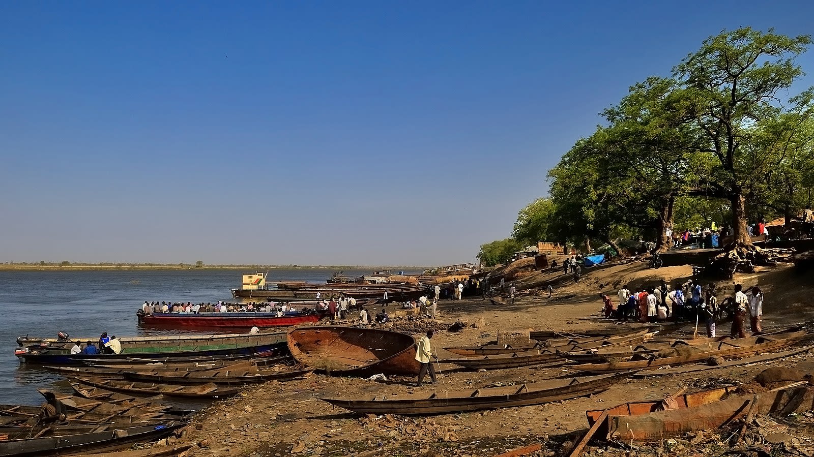
The town of Malakal (capital of the Upper Nile State) is located on the banks of the White Nile, just north of its confluence with the Sobat River. Photo: Michael Walsh
The town of Malakal (capital of the Upper Nile State) is located on the banks of the White Nile, just north of its confluence with the Sobat River. Photo: Michael Walsh
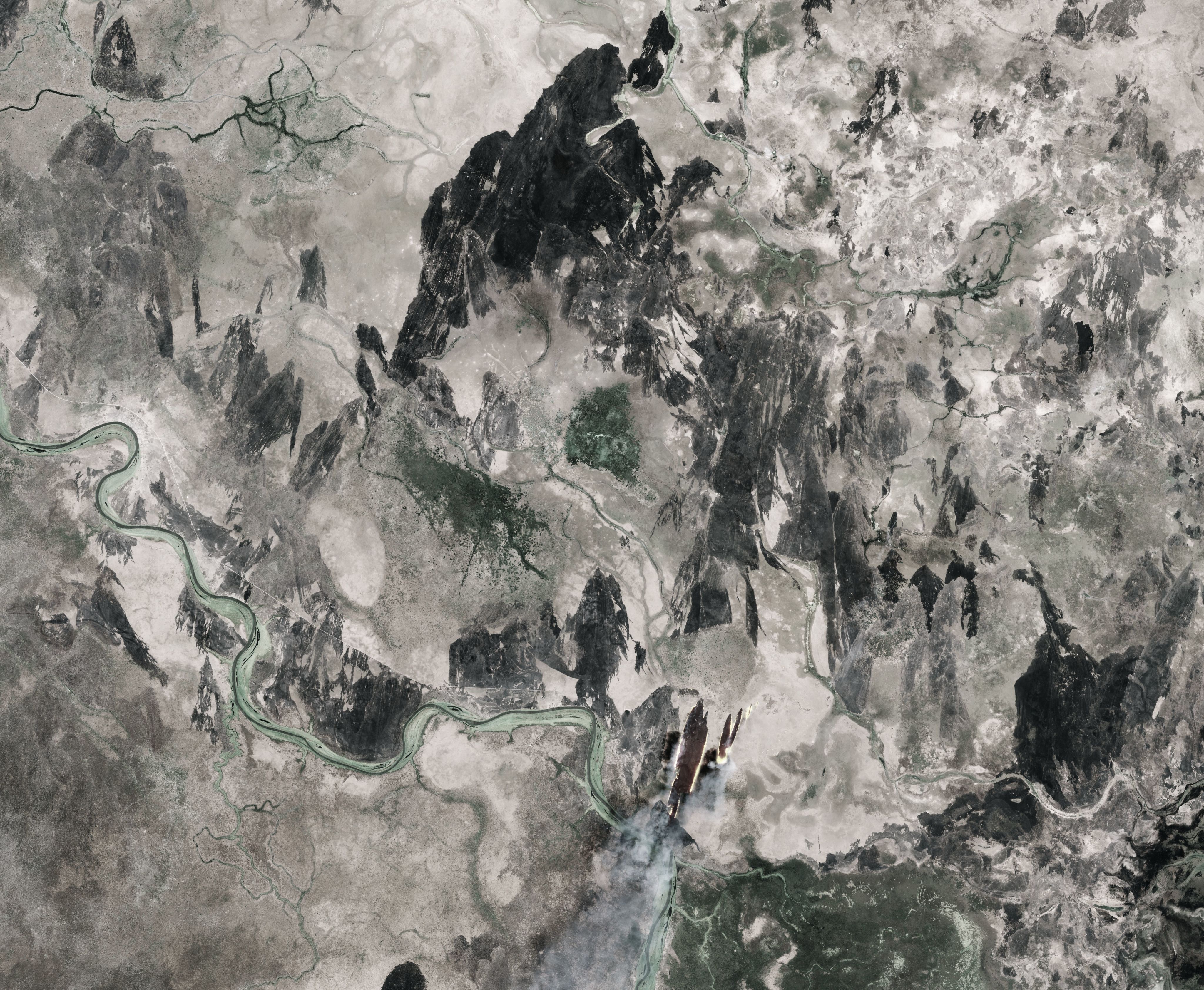
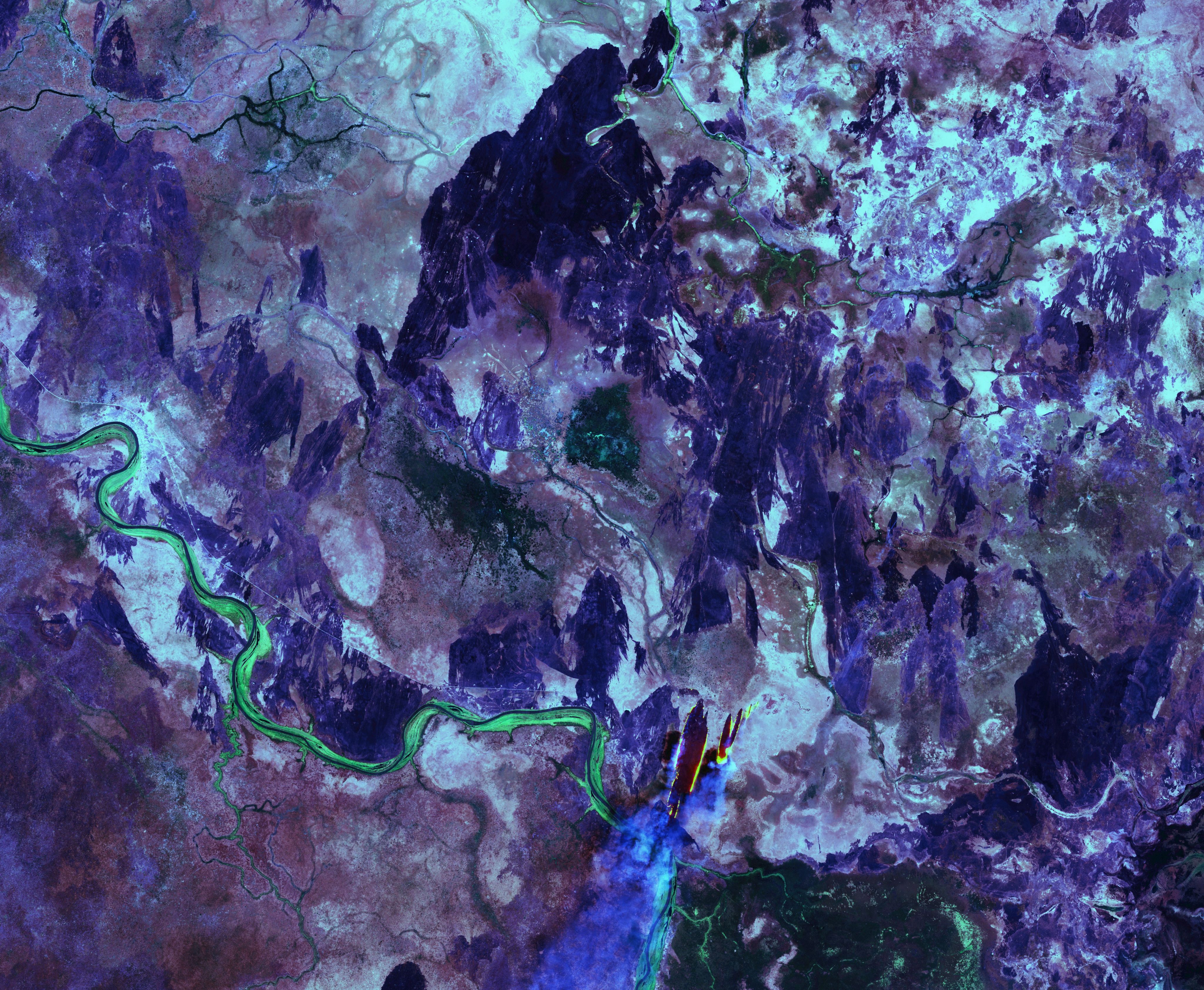
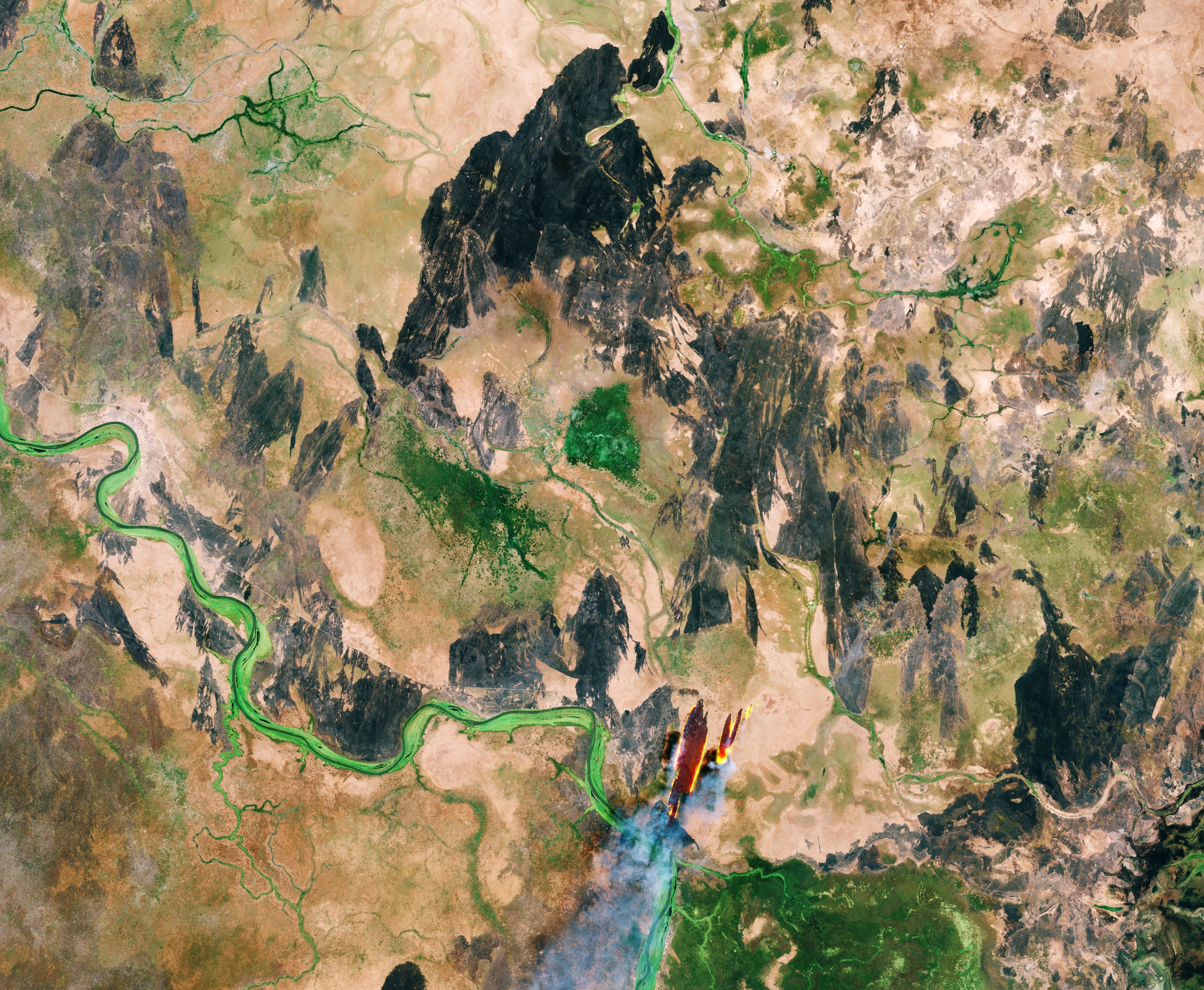
Tropical forests, swamps and grassland make up the majority of South Sudan’s terrain. A large, swampy area called the Sudd Wetland, which is about 320 km wide and 400 km long, is located in the center of the country. This is one of the largest freshwater ecosystems in the world and a major source of livelihoods for millions of South Sudanese.

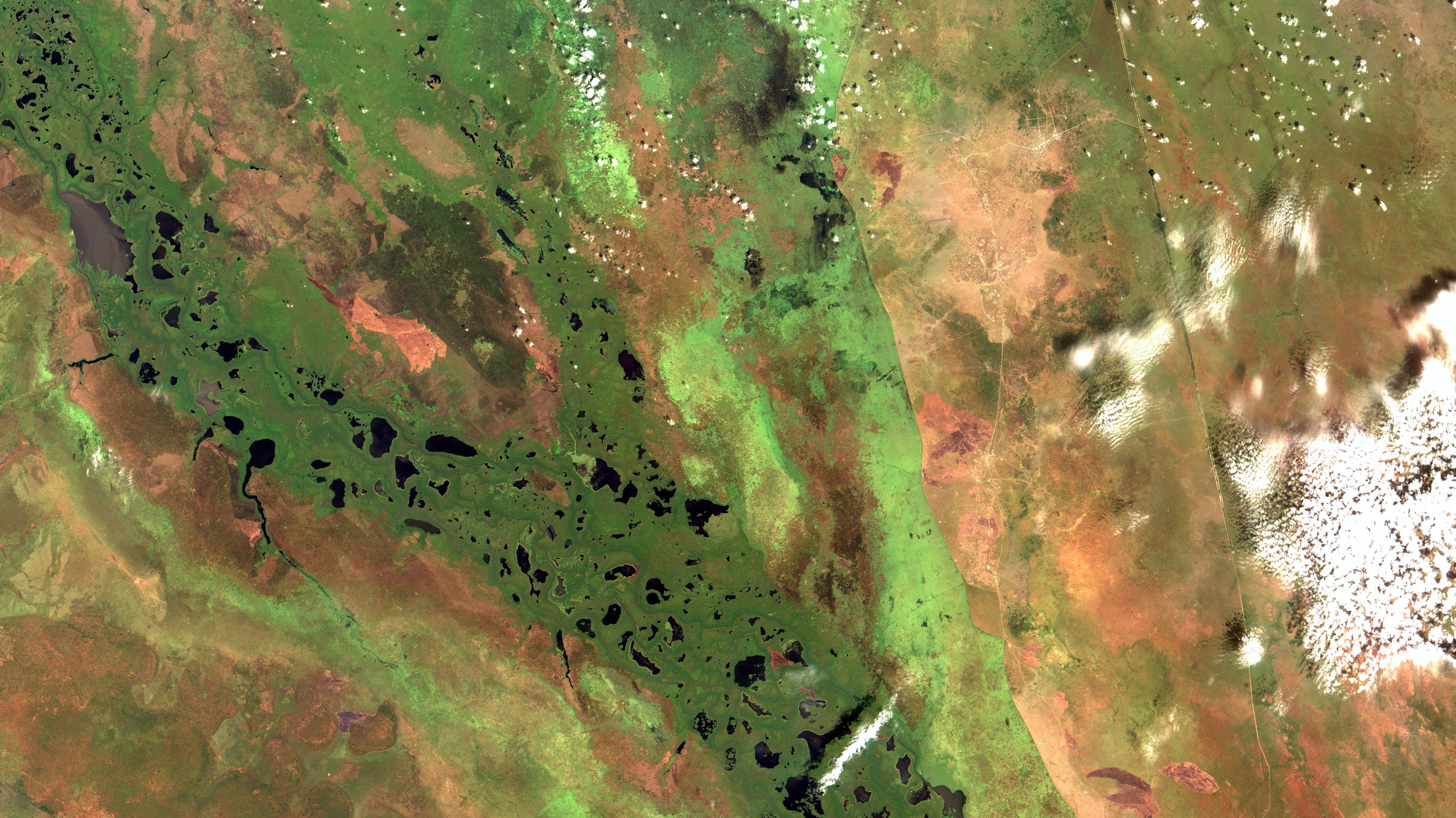
Satellite imagery of the southern part of the Sudd wetland, in South Sudan. In black color the open water surface of the lakes. Crossing the image diagonally, in brown, the White Nile and tributaries. In dark green, in the flooded floodplain, mainly large grasses and sedges (reeds). Satellite Imagery: Oton Barros (DSR/OBT/INPE)
Satellite imagery of the southern part of the Sudd wetland, in South Sudan. In black color the open water surface of the lakes. Crossing the image diagonally, in brown, the White Nile and tributaries. In dark green, in the flooded floodplain, mainly large grasses and sedges (reeds). Satellite Imagery: Oton Barros (DSR/OBT/INPE)
Protecting development gains
Managing flood risks and drought impacts are key to water security
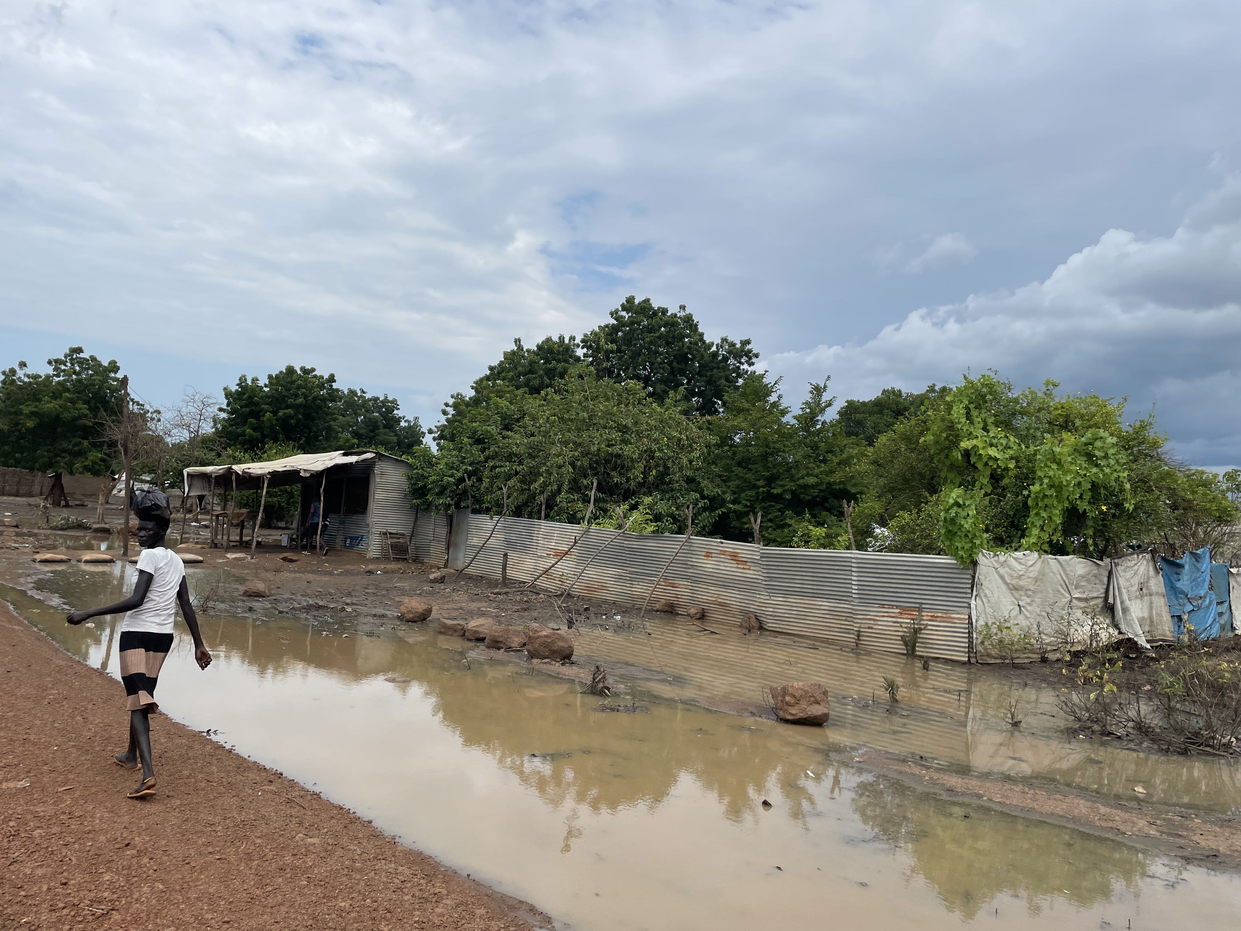
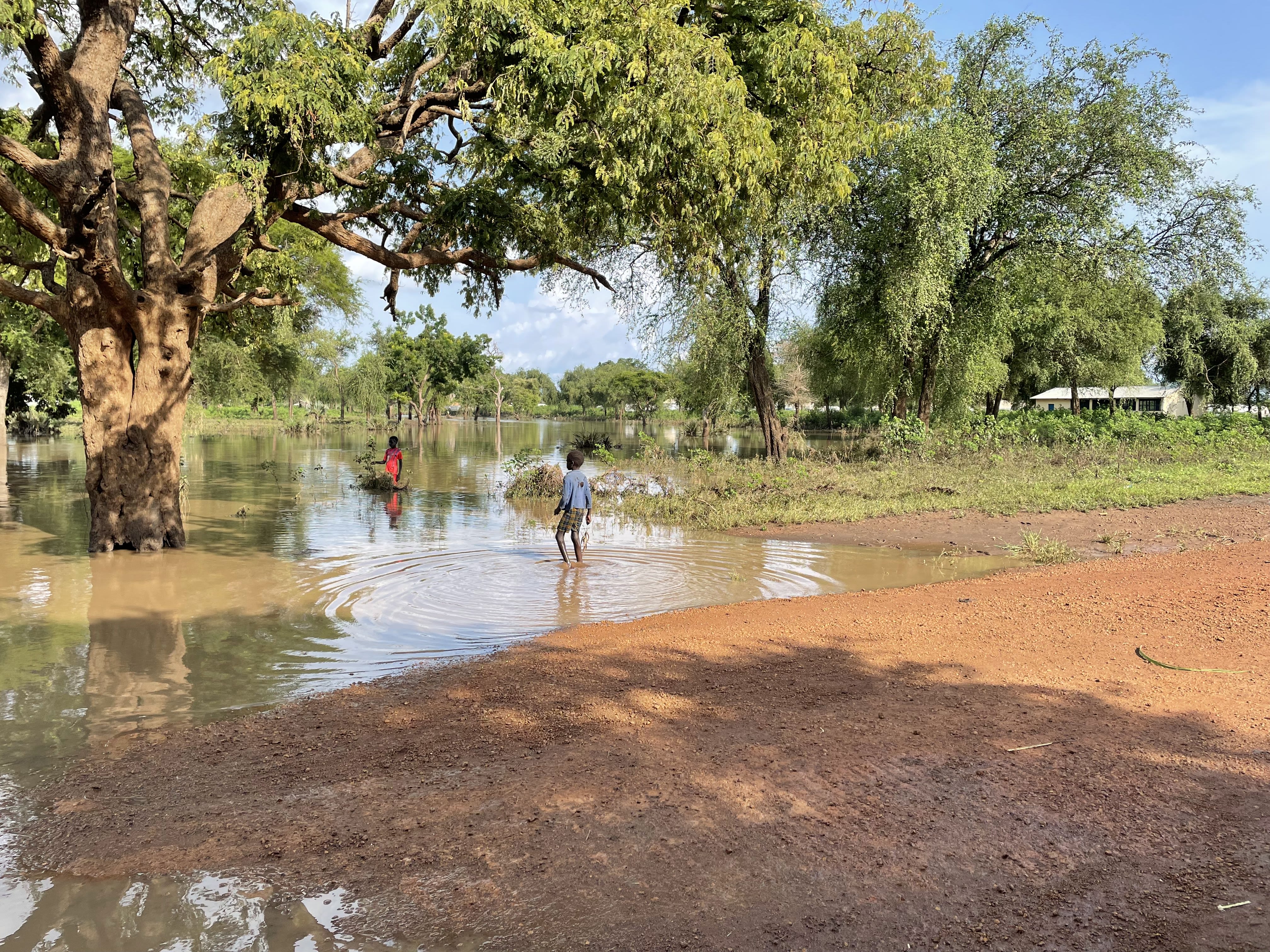
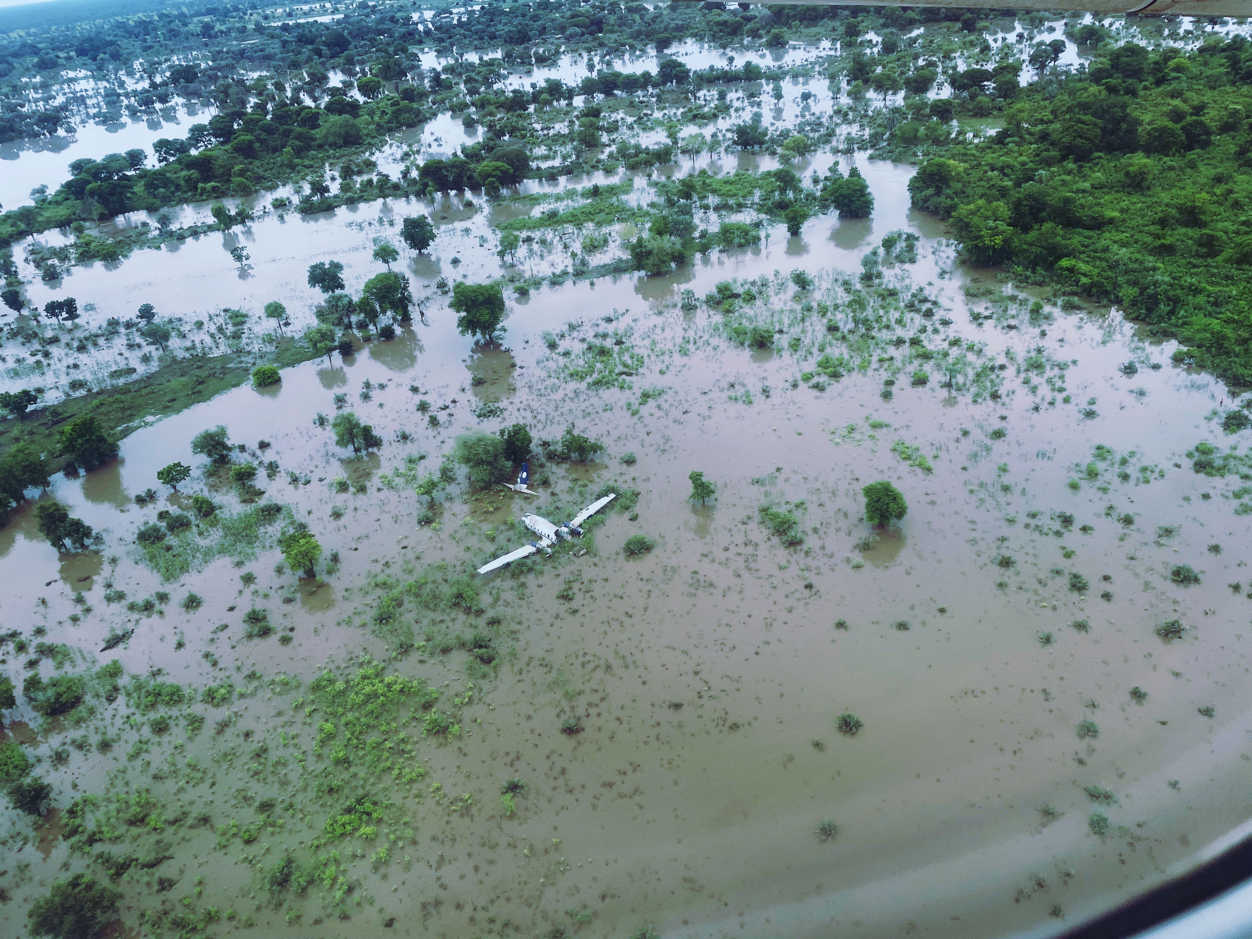
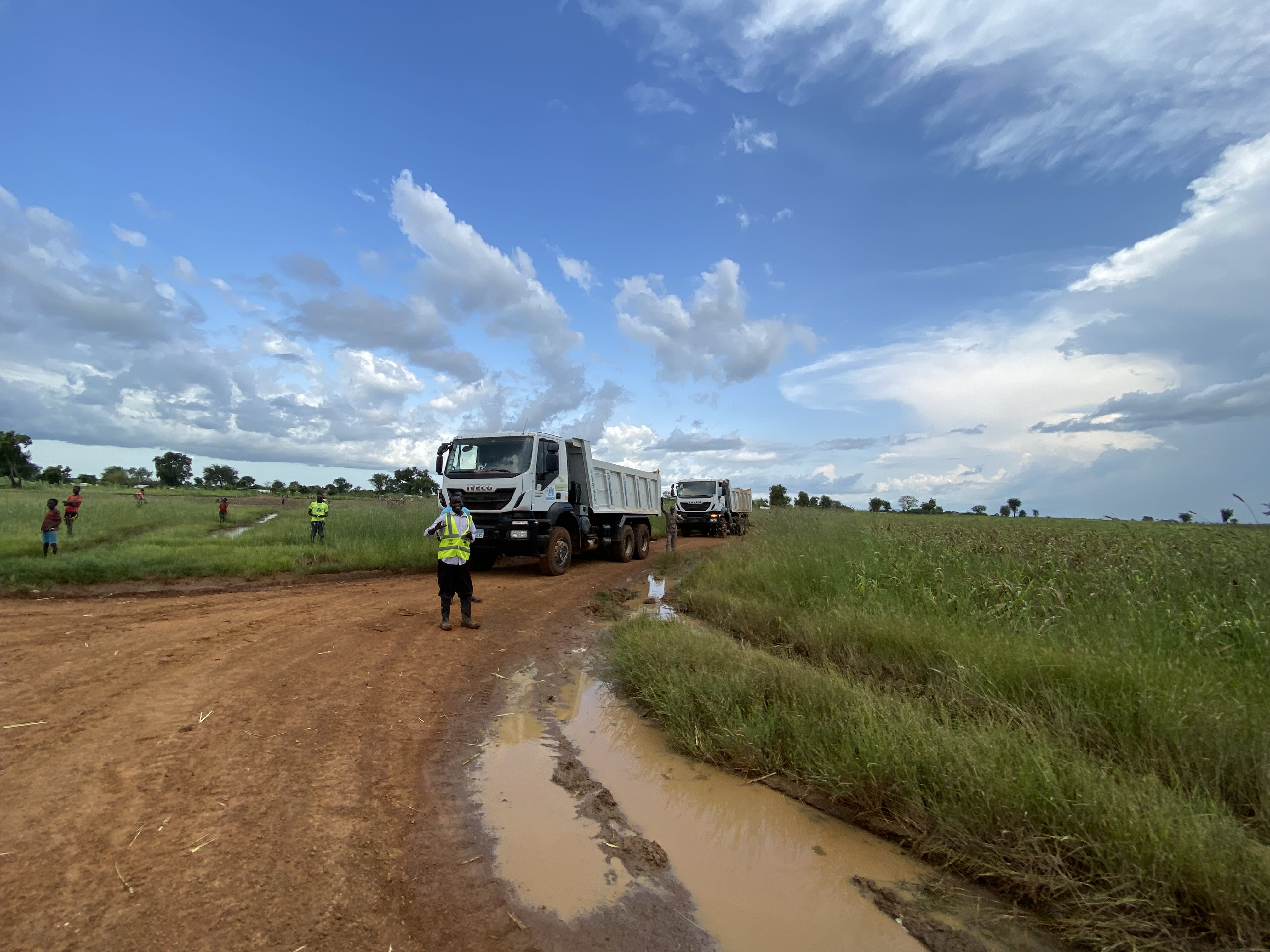
Floods and droughts are the most obvious manifestations of South Sudan’s highly variable and unpredictable freshwater resources. The impacts of floods and droughts in South Sudan are growing, not only because climate change is increasing their frequency and intensity, but also because protracted armed conflict and forced displacement are pushing more people and assets into harm’s way.

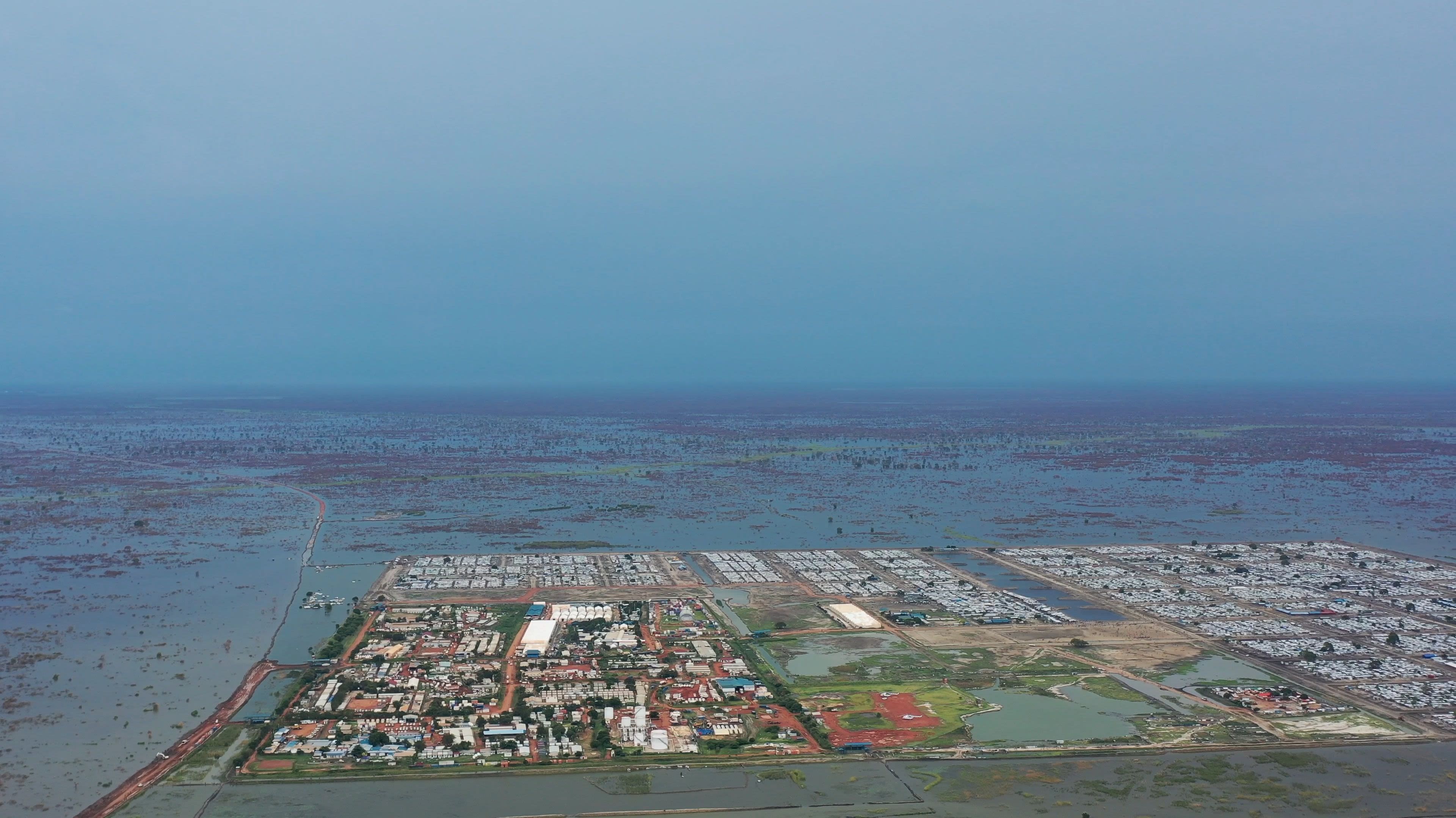
South Sudan is a global hotspot for flood risk
More recently, South Sudan suffered three consecutive years of exceptionally severe flooding in 2019, 2020 and 2021, and climate outlooks indicate that the upcoming rainy seasons will likely also bring above-average rainfall and flooding. South Sudan faces flood hazards from both fluvial sources and pluvial sources. As seen in the recent December 2020 floods (see below), interactions between local and global climate patterns influence the occurrence of floods. Warming in the Western Equatorial Indian Ocean can bring excess precipitation to the African Great Lakes region and South Sudan, causing riverine flooding in the center and eastern parts of the country, where the largest rivers are located.


Droughts are a recurring, persisting risk in South Sudan
Considerable hydrological irregularity (as seen previously) also means that South Sudan is at risk from droughts, which have displayed significant territorial and seasonal inconsistency between 1982 and 2021. As seen in the map below, droughts tend to be more frequent in south-eastern and north-eastern regions than in other parts of the country.
In these areas, droughts can affect the mobility options of pastoralists and others who rely on natural resources for their livelihoods, bringing them into competition with neighboring communities and increasing the risk of cattle raids.
In the period considered in this analysis (1982–2021), the southeast states (Jonglei, Eastern Equatoria and Lakes) faced more than 10 drought events. The northern and western states (Northern Bahr el Ghazal, Warrap, and Upper Nile states) recorded fewer drought episodes; however, these droughts have tended to last longer and have been more intense.
As temperatures increase because of climate change, the frequency and intensity of droughts is projected to increase. These increasing temperatures will amplify the impact of drought, as warming typically leads to increased evaporation and further reductions in the availability of water.
Droughts are very frequent in the south and north east; under climate change, droughts are projected to become 60% to 100% more frequent compared to the 2020s by the end of the century.

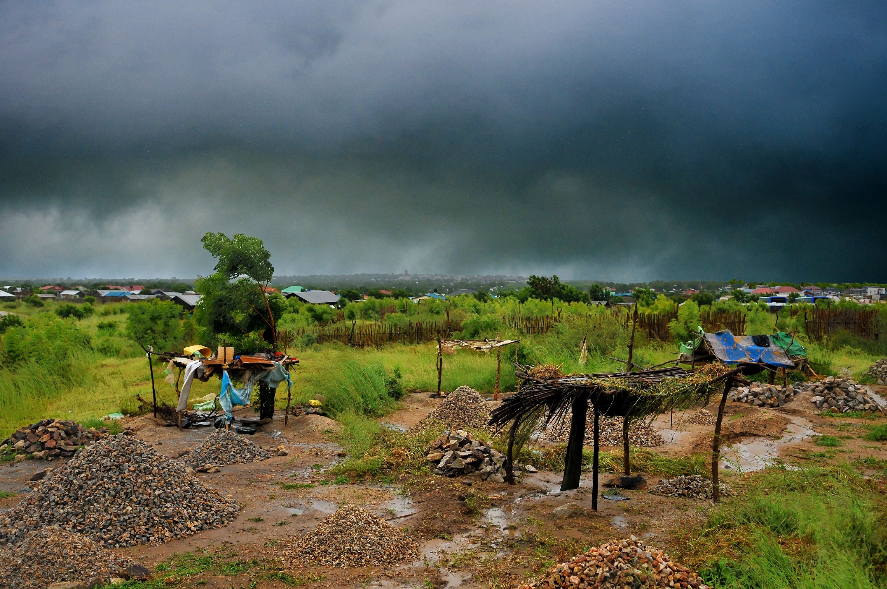
Photo: Michael Walsh
Photo: Michael Walsh
Future climate-related disruptions
These water-related disasters exacerbate an already challenging situation, characterized by a protracted humanitarian and forced displacement crisis, unprecedented levels of food insecurity, widespread violence, and fragile institutions.In South Sudan, most of the harm from climate change will come in the form of water: increased frequency of droughts and floods, changes in flow patterns in rivers, lower water quality, and impacts on groundwater availability.
Supporting healthier communities
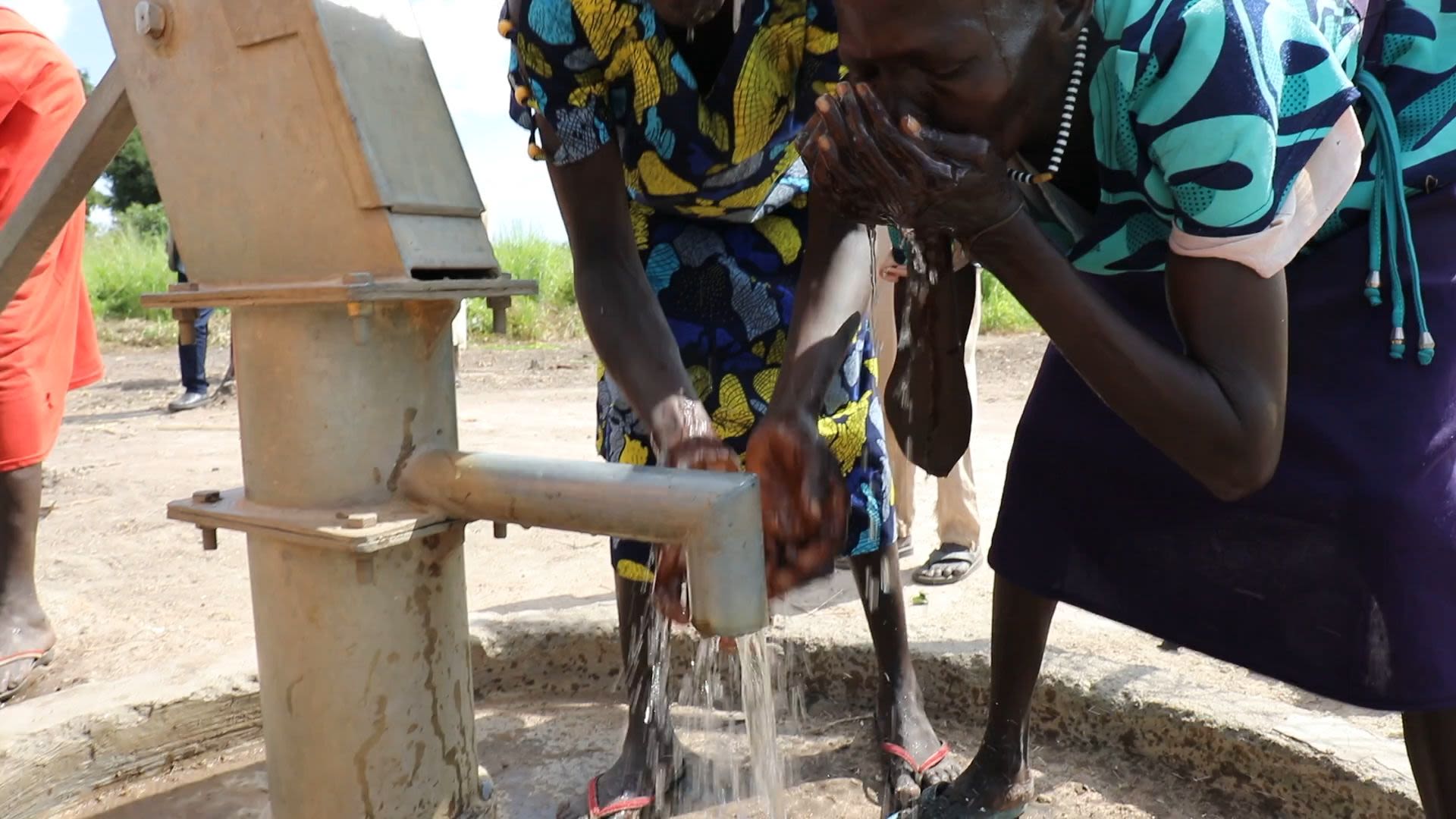
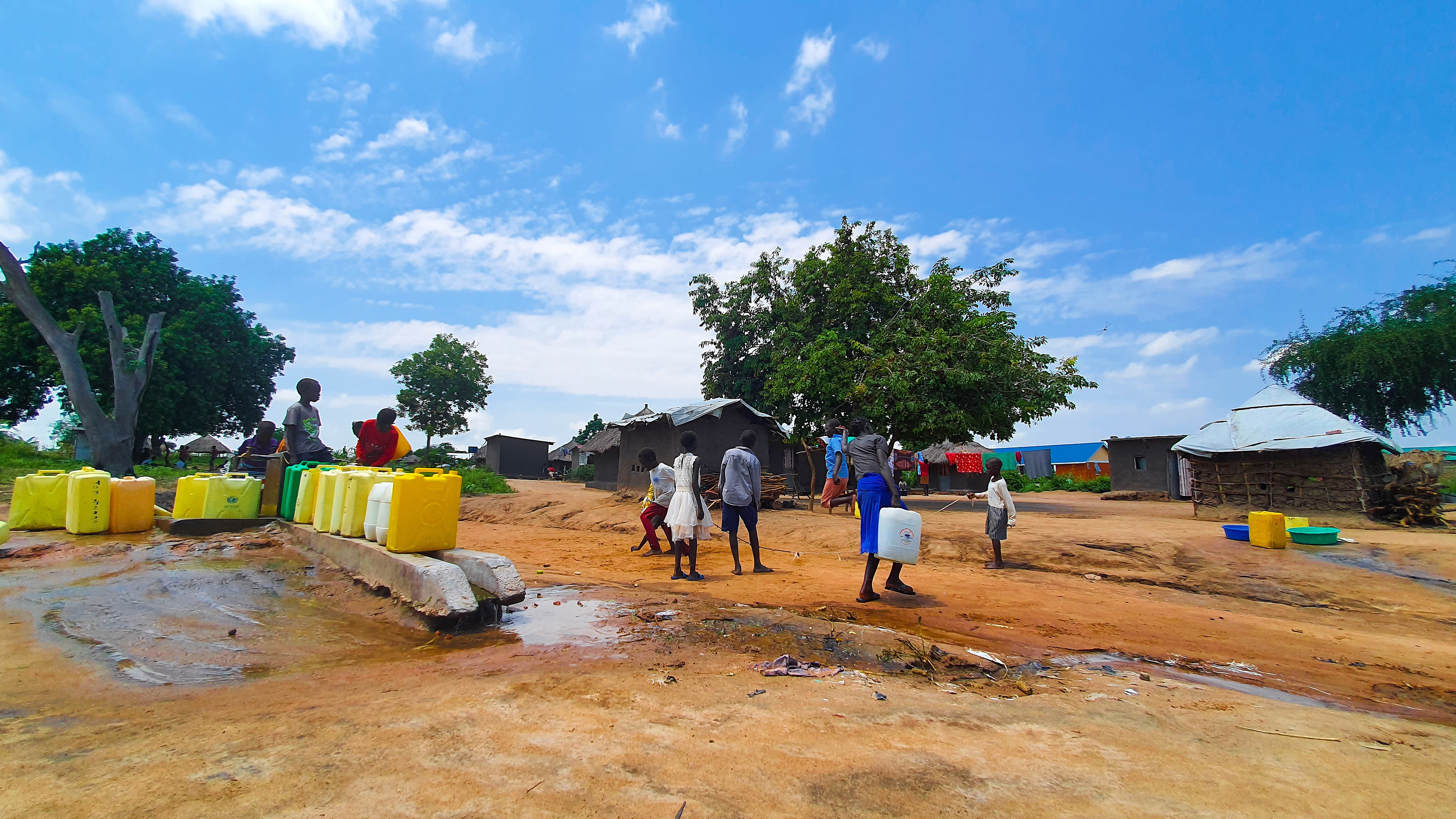
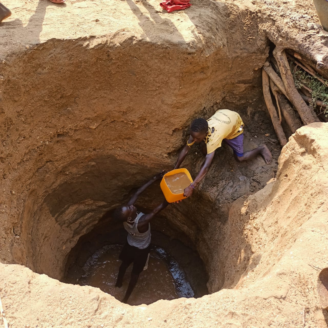
While flood events often capture headlines, they are just one of the many threats stemming from water insecurity. For instance, at a community level, the lack of access to safe drinking water and sanitation facilities remains a core issue of concern for the dignity and well-being of millions of South Sudanese across the country.
Today, around 60% of households continues to use unimproved water sources - such as surface water and unprotected wells - and 75% still practice open defecation.
There is also a large urban-rural divide with regards to drinking water and sanitation, with most improvements reported for urban areas, thus failing to reach most South Sudanese over the past 9 years.
In urban areas, access to at least basic drinking water sources has improved in the last decade, increasing from 52% in 2011 to 70% in 2020, while in rural areas, access to at least basic drinking water supplies declined from 39% in 2011 to 34% in 2020.

Source: Ronald Lomora
Source: Ronald Lomora
Today, access to drinking water differs between the dry and rainy seasons across South Sudan, with most states and administrative areas having lower access to basic water supply during the rainy season.
Even at these levels, access to basic water supply is often disrupted during the rainy season, due to floodwaters submerging water sources and making water points inaccessible. There are numerous accounts of water sources being submerged by floodwaters during the rainy season, forcing households to seek out other sources of water that may require them to walk longer distances or be of lower quality.

Source: Rift Valley Institute
Source: Rift Valley Institute

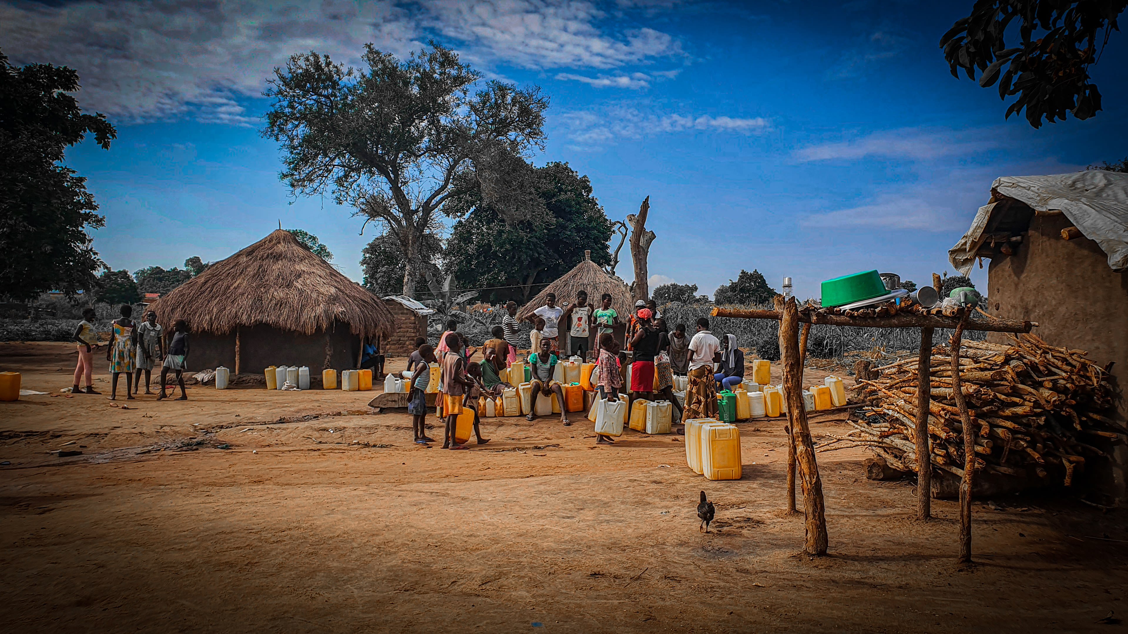

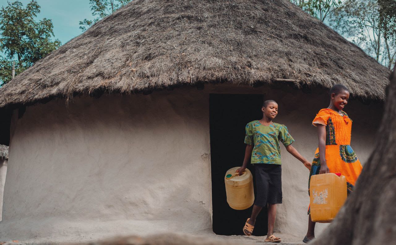

Photo: Ronald Lomora
Photo: Ronald Lomora

Photo: Asunta Sura
Photo: Asunta Sura
Boosting food security
and livelihoods
Water resources are crucial for livelihoods and food security
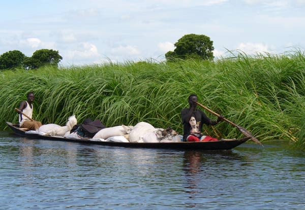
Today, most South Sudanese derive their livelihoods from activities in areas that are highly dependent on water availability and variability. It is the combination of these activities that shapes sustenance levels as well as income generation. Water's productive potential sustains a wide range of livelihoods and ecosystems services across South Sudan - including local agriculture, pastoralism and freshwater fisheries.
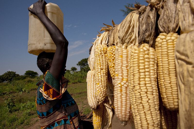
Photo: World Bank
Photo: World Bank
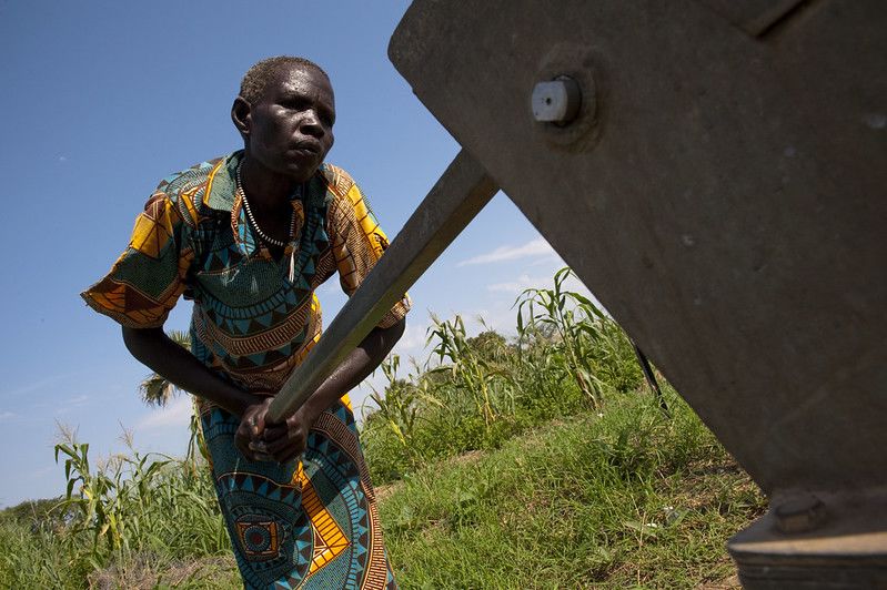
Local Agriculture
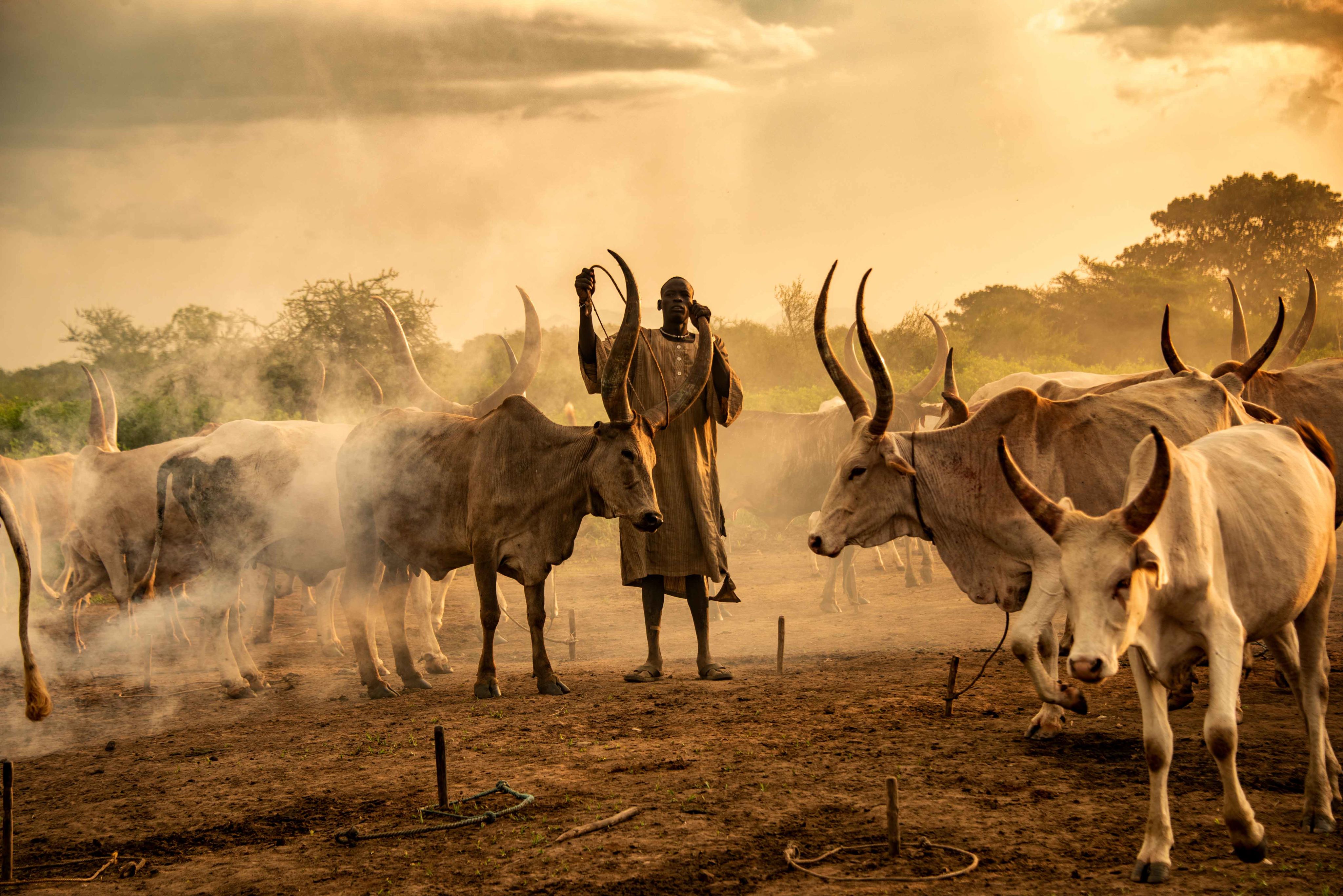
Photo: Rod Waddington
Photo: Rod Waddington
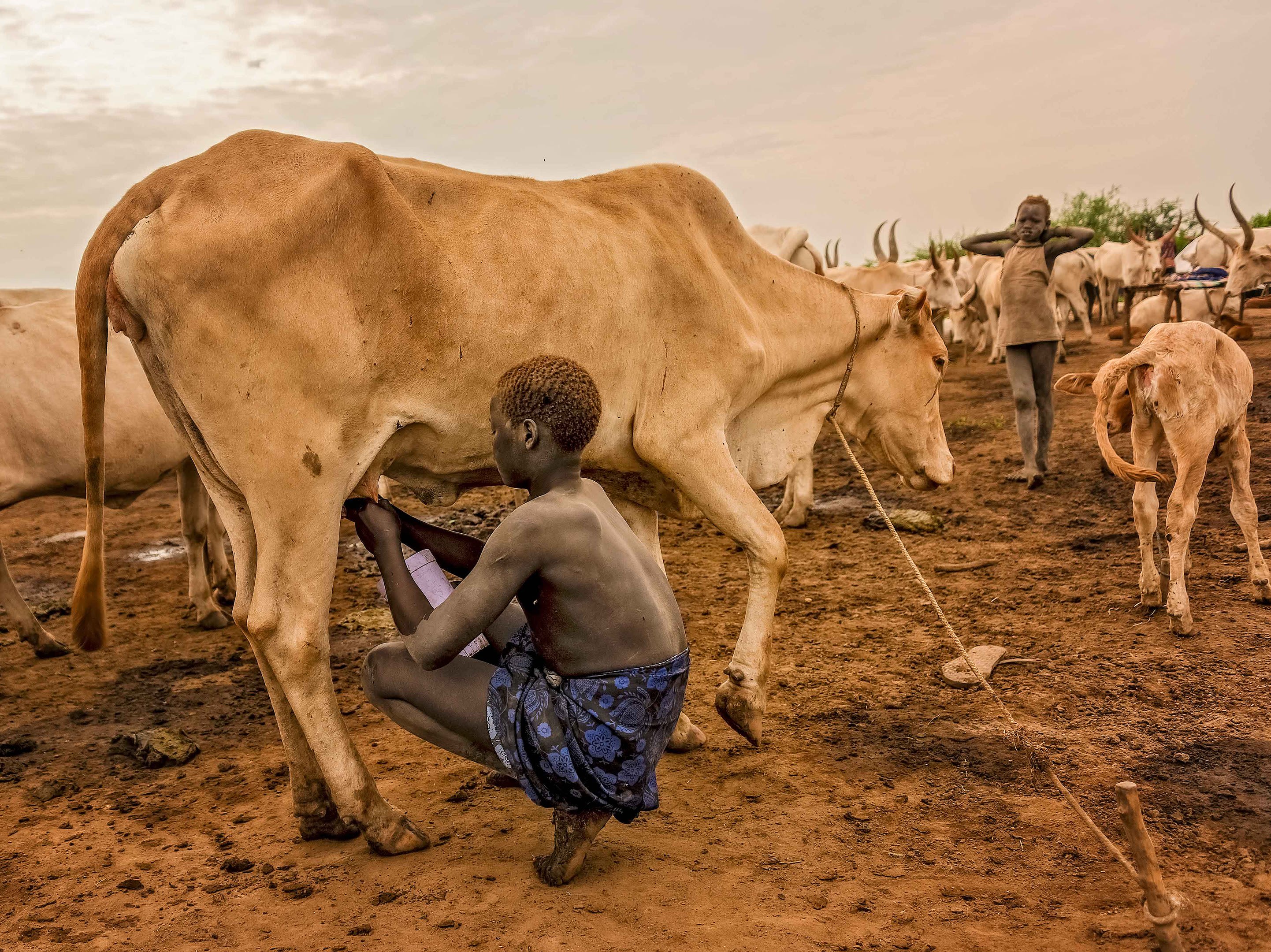
Pastoralism
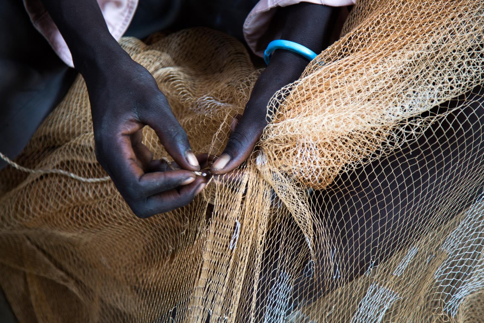
Photo: FAO/Albert Gonzalez Farran
Photo: FAO/Albert Gonzalez Farran
Freshwater Fisheries
"Water is food."

A closer look at the South Sudan's dominant livelihood zones, population distribution, and corresponding water resources suggests that South Sudan's livelihood systems are a combination of five activities: cattle grazing, crop production, wild food collection, fishing and hunting, and trade.
Out of a total agricultural land of about 28.5 million hectares, as much as 24 million hectares are suitable for irrigated agriculture.
South Sudan's irrigation potential remains untapped
Innovations in irrigation service provision offer opportunities to enhance water’s contribution to livelihoods and food security.
Irrigated agriculture currently makes up less than 5% of the total area under cultivation in South Sudan.
Today, South Sudan has some of Sub-Saharan Africa’s highest solar adoption potential, with a suitable area for solar-based irrigation of 6 to 10 million hectares (for groundwater) and 1 to 3 million hectares (for surface water).

For instance, an opportunity for expansion of irrigated agriculture are small-scale solar powered irrigation systems. In the context of underdeveloped electricity infrastructure, off-grid solar photovoltaic irrigation is an important alternative for pumping and for improving rural communities’ livelihoods.

Towards a water-secure future

How can fragile countries like South Sudan better harness water’s potential to sustain development and stability?
A new World Bank report “Rising from the Depths: Water Security and Fragility in South Sudan” highlights five priorities that could make a difference.
1. Strengthen policies and institutions to manage water resources sustainably
This involves empowering and building the capacity of those working in the sector, updating existing policies, and developing a water resources master plan.

2. Address the water supply and sanitation crisis
This can be achieved by improving service delivery in rural areas, promoting the sustainable use of groundwater resources, and investing in climate-resilient solutions. Collaboration with international partners is crucial to make this happen.
3. Improve disaster risk preparedness and early warning systems
Responding to floods and droughts requires more than just building infrastructure. It also involves preventing populations from moving into harm’s way and setting up information systems to increase preparedness and early warning. In the short-term, expanding hydro-meteorological services, early warning systems, and delineating flood-prone areas are important steps to reduce losses from floods and droughts.
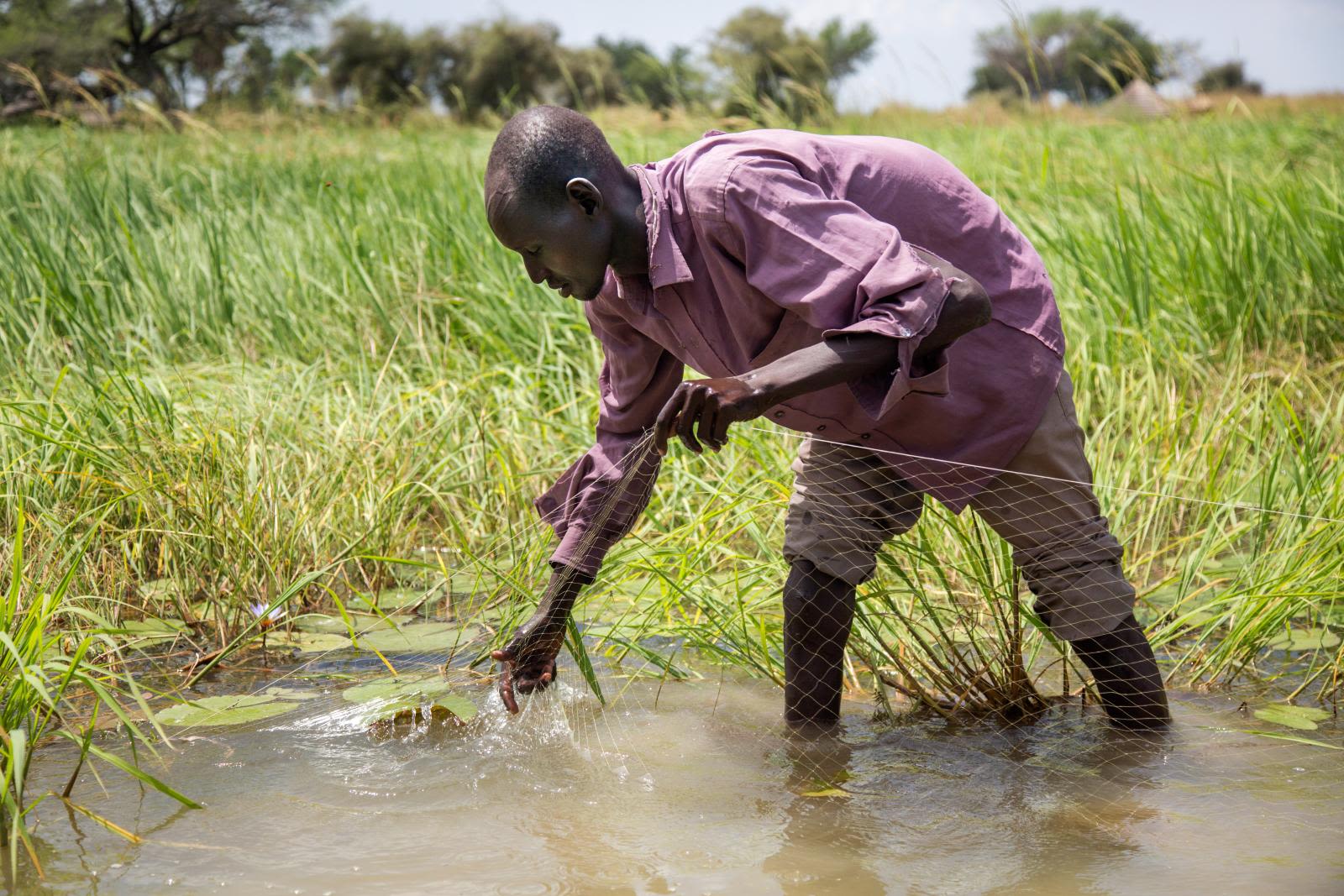
Photo: FAO/Albert Gonzalez Farran
Photo: FAO/Albert Gonzalez Farran
4. Use water resources to support livelihoods and ecosystem services.
This includes investing in domestic fish production, wetland restoration, and flood-recession agriculture.
5. Choose a range of infrastructure options to manage water resources
While large-scale river engineering projects may help improve water security, the absence of sector frameworks, required feasibility assessments, and capacity for strategic planning and infrastructure management mean that these projects are unlikely to deliver the expected outcomes and could have unintended consequences. In the short-term, policymakers should prioritize community-level water storage and flood control alternatives that can be built quickly and with fewer harmful environmental and social externalities.
Related content:
Video and Photo credits: World Bank Group unless otherwise noted.
This immersive story was designed and developed by Yann Kerblat, with suggestions from Edoardo Borgomeo and Claire Chase.
The Global Water, Security, and Sanitation Partnership (GWSP) supported this work.